
Integrating Remote-Sensing and Ecological Forecasting into Decision-Support for Wetland Wildlife Management and Ecosystem Services in the Central Valley of California: Optimizing Across Multiple Benefits
|
This project, funded by the NASA Applied Sciences Ecological Forecasting Program, will use Earth Observation time-series and biological observations to help forecast and prioritize where to put water to optimize multiple-benefits across the large mosaic of California’s Central Valley croplands and wetlands; a region required for the wide-ranging ecology of migratory waterbirds. We will assess habitat connectivity and its influences on multiple taxa as it changes over time within a year and under future scenarios. This timely, readily-accessible information will serve as a catalyst for coordinated large-scale water and wetland conservation and management, and will be used by The Nature Conservancy's BirdReturns Program and the California Lanscape Conservation Cooperative's Central Valley Landscape Conservation Project. To support decision-making collaborators, the project will take advantage of the regular return interval of satellite data and state-of-the-art bioinformatics to develop a web-based decision support framework that can compile and evaluate the data developed from this project and provide ongoing updates through time. The project's scientists and informatics team will develop and use multi-annual forecasts, as well as long-term projections (50 years), of the spatial and temporal availability of wetland habitats, wetland and open water dependent species, connectivity, biodiversity and groundwater recharge to prioritize and strategically create wetland habitat on the landscape as part of large-scale coordinated conservation using a decision-support application. Integrating the water and wetland habitat forecast models with species and ecosystem services distributions through a spatially-explicit conservation prioritization framework will provide the essential resources for improved, coordinated landscape-scale conservation decisions that optimize across multiple benefits. |
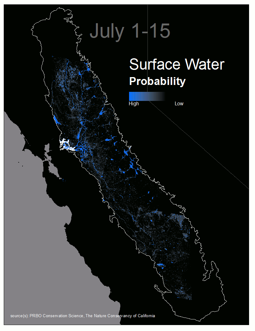
Animated sequence of surface water distribution on the Central Valley landscape |
.jpg) Wetland and waterbirds at Butte Sink Wildlife Management Area |
This exciting work began at Point Blue with the Automated Water Resources Tracking System, which automated a process to rapidly quantify open surface water and wetland habitats in the Central Valley and is already making water map data available. Project Leads: Matt Reiter, Point Blue Conservation Science and Kristin Byrd, US Geological Survey |