
Bay Area Watershed Analyst: About the Watersheds
Why Watersheds?
A watershed is a geographic area of land, water, and biota within the confines of a drainage divide. Watershed boundaries define the aerial extent of surface water drainage to a point and are defined by boundaries that run along the highest ridgeline around the stream channels and meet at the bottom or lowest point of the land where water flows out of the watershed. The landscape can be thought of as a nested set of watersheds, with the largest divisions the drainages of big rivers and the smallest sub-watersheds delineating the drainages of the tributaries.
Watersheds are a natural geographic boundary for analyzing and planning for natural resources. Many aspects of water security, species conservation, ecological restoration, vegetation management and land planning are best thought about as operating within watersheds.
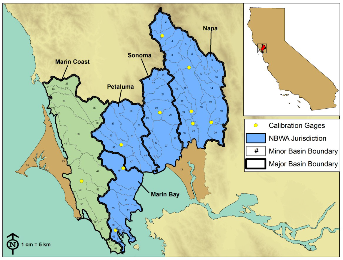
North SF Bay Area Major and Minor Watershed Basins, from Micheli, et. al. 2010. Adapting to Climate Change State of the Science for North Bay Watersheds: A Guide for Managers. Pepperwood Preserve, Santa Rosa, CA.
About the Watersheds chosen for the Watershed Analyst tool.
The climate and water data in the Watershed Analyst are presented at a "planning watershed" scale-- these are the smallest sub-watersheds that make up the major basins of the Bay Area, as shown in the map below. For example, the Petaluma watershed is comprised of eight minor basins, or planning watersheds, as seen in the map above. This is the smallest area at which climate and hydrologic change can be meaningfully examined given the resolution of the Basin Characterization Model data.
The watershed boundary data used in the Watershed Analyst tool come from the CalWater 2.2.1 Watershed Boundaries geospatial dataset.