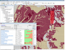
NatureServe Vista® is a free, ArcGIS extension that automates advanced spatial analyses for planners and managers. It is a highly capable decision-support system that helps users integrate conservation with many types of planning such as land use and natural resource management, infrastructure and transportation, energy development, and climate change adaptation. Users can characterize their features of interest, integrate expert knowledge, create and evaluate different spatial scenarios to determine where and how their values are supported or threatened, and develop site mitigations or complete new alternatives to best achieve planning objectives. Vista also supports ongoing plan implementation and adaptive management.