
Article
About Raster Resolutions
Here are three examples of grids covering the same geographic area (western El Dorado County, near Sacramento). They represent different data from different sources, so the colors and shapes are not meaningful to compare, but they do illustrate the difference in grid cell size (resolution).
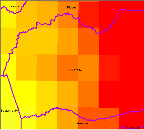 |
This is a raster with 1/8th degree resolution; each data value represents an area equivalent to a 7.5' topo map (although the grid cells are offset differently). An example of climate change data with this resolution are the datasets found in CalAdapt. |
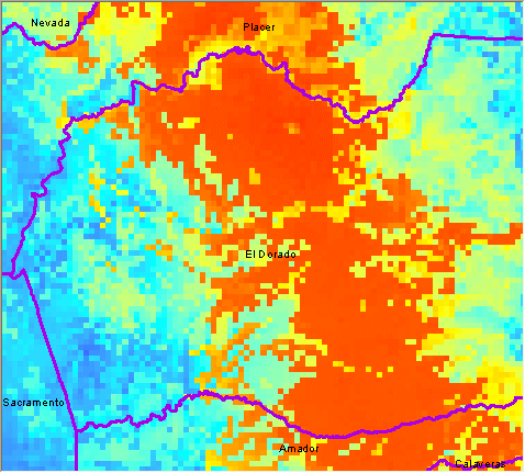 |
This is a raster with 800 meter cells. It's not the same data as the previous, and is only used to give you a sense of the size of the pixels. An example of climate change data with this resolution are those found in the California Environmental Change Network. |
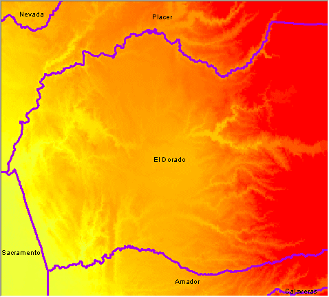 |
This is a raster with 270 meter cells. This represents similar data to the first example above (minimum temperature), but from a different source. An example of climate change data with this resolution are the California Basin Characterization Model datasets. |
Subjects:
Last Updated:
6/2015