Dataset

A Seamless, High-Resolution Digital Elevation Model (DEM) of the North-Central California Coast

Commons Hosting
Climate Commons Hosting Status: 
Eligible
Basic Information

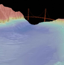
A seamless, 2-meter resolution digital elevation model (DEM) of the north-central California coast has been created from the most recent high-resolution bathymetric and topographic datasets available. The DEM extends approximately 150 kilometers along the California coastline, from Half Moon Bay north to Bodega Head. Coverage extends inland to an elevation of +20 meters and offshore to at least the 3 nautical mile limit of state waters.

Creator: 
Foxgrover, Amy C. and Barnard, Patrick L.
Publisher: 
U.S. Geological Survey
Subjects:
Spatial Resolution: 
2 meters
Date Issued: 
2012
Parameters / Choices
A dataset often contains many geodata layers representing the same kind of measurement, but for different values of some parameters - time periods, models or scenarios, different species, etc. A value must be chosen for each such parameter in order to select a specific layer or raster which associated a single value with each geographic location (cell). The parameters or choices relevant to selecting layers from this dataset are described here.