
Intro to the Basin Characterization Model
The Basin Characterization Model (BCM) models the interactions of climate (rainfall and temperature) with empirically measured landscape attributes including topography, soils, and underlying geology. It is a grid-based model that calculates the water balance (the amount of water in each of the fractions of the total water budget, including runoff, recharge, and evapo-transpiration) for each 18-acre cell (270m resolution) in a given watershed in set time steps for the entire area. The California BCM uses a minimum time step of monthly results at the scale of a 270m grid, allowing the generation of scenarios at annual, seasonal, or monthly time steps.
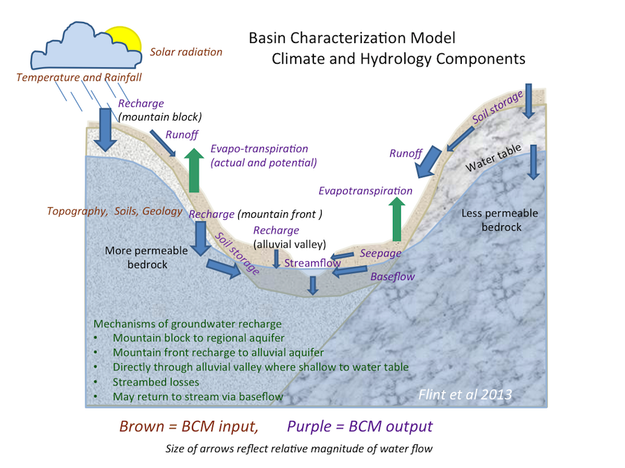
The diagram below depicts the climate and hydrology components that comprise the inputs and outputs of the BCM. Here is a short video with Lorraine Flint describing the components of the model.
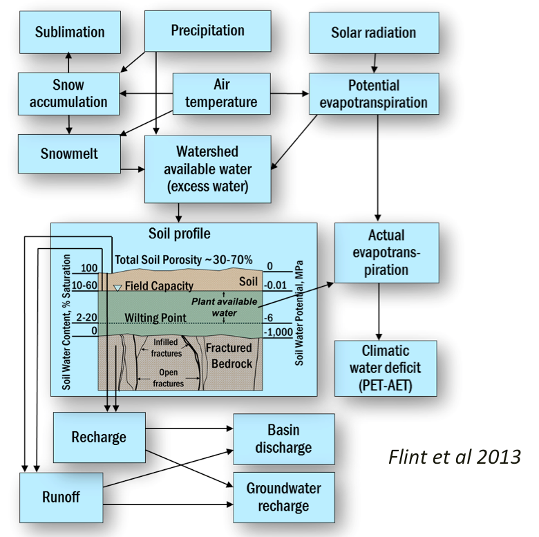
Below is a schematic of the model. Listen to Lorrie Flint explain these elements in this short video.
Back to the BCM Homepage
Back to the Climate Ready North Bay Homepage