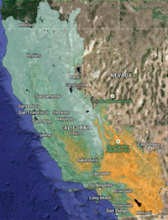
The California Basin Characterization Model (CA-BCM 2014) dataset provides historical and projected climate and hydrologic surfaces for the region that encompasses the state of California and all the streams that flow into it (California hydrologic region ). The CA-BCM 2014 applies a monthly regional water-balance model to simulate hydrologic responses to climate at the spatial resolution of a 270-m grid. You can download a vector
boundary of the dataset here.
The model has been calibrated using a total of 159 relatively unimpaired watersheds for the California region. The historical data is based on 800m PRISM data spatially downscaled to 270 m using the gradient-inverse distance squared approach (GIDS), and the projected climate surfaces include five CMIP-3 and nine CMIP-5 General Circulation Models under a range of emission scenarios or representative concentration pathways (RCPs) for a total of 18 futures that have been statistically downscaled using BCSD to 800 m and further downscaled using GIDS to 270 m for model application.
The BCM approach uses a regional water balance model based on this high resolution precipitation and temperature as well as elevation, geology, and soils to produce surfaces for the following variables: precipitation, air temperature, April 1st snowpack, recharge, runoff, potential evapotranspiration (PET), actual evapotranspiration, and climatic water deficit, a parameter that is calculated as PET minus actual evapotranspiration.
The revised modeling for the CA-BCM described in Flint et al. 2013, referenced below, includes the updated 800-m spatial resolution climate data from PRISM, the county level soils data (SSURGO) for the entire state, and more rigorous snow and PET calibrations for California. This dataset included updates to all the basin calibrations as well. The future climate projections included the original 4 projections that were revised with bias-corrections to the 800-m historical PRISM climate, plus an additional 3 projections from the CMIP3 dataset (IPCC 4th Assessment Report) and 11 projections from the CMIP5 datasets (IPCC 5th Assessment Report). These projections included a range of emissions scenarios and representative concentration pathways. All projections were processed by the BCM to provide hydrologic response to 18 future climates.
The data available online are all possible combinations of the following parameters:
GCMs and ES/RCP
combinations (for futures only)
|
Variables
|
Statistics
|
30-year summary
time periods
|
|---|
CMIP 3:
GFDL-A2
GFDL-B1
PCM-A2
PCM-B1
MIROC3_2 -A2
CSIRO-A1B
GISS_AOM -A1B |
CMIP 5:
MIROC5-RCP26
MIROC-RCP45
MIROC-RCP60
MIROC-RCP85
GISS-RCP26
MRI-RCP26
MPI-RCP45
CCSM4-RCP85
IPSL-RCP85
CNRM-RCP85
FGOALS-RCP85 |
precipitation
max temp
min temp
climatic water deficit
potential ET
actual ET
April 1 snowpack
recharge
runoff
|
average (ave)
standard deviation (std)
detrended standard deviation (dsd).
|
Historic:
1921-1950
1951-1980
1981-2010
Projected:
2010-2039
2040-2069
2070-2099
|
Please see:
The Basin Characterization Model Downscaled Climate and Hydrology Dataset for more information about the BCM datasets.