
Home on the California Range, Year 2100
How Maintaining California's Rangelands Benefits Wildlife and Water Supplies
By Bonnie Dickson and Laurel Rogers, USGS California Water Science Center
 |
“Results from this study reinforce the role of open rangelands in capturing water and reducing runoff. Maintaining rangelands can help mitigate the effects of climate change and drought." |
Grassland habitats on rangelands in California’s Central Valley and surrounding foothills could decline by as much as 37 percent by 2100 due to changes in land use and climate, according to “Integrated climate and land use change scenarios for California rangeland ecosystem services: wildlife habitat, soil carbon, and water supply,” by USGS researchers funded by the California Landscape Conservation Cooperative.
In addition to habitat loss, the study shows that increased development of rangelands for urban use exacerbates the ongoing issues surrounding rainwater runoff. When this issue is combined with periods of drought, the area will suffer from reduced opportunities for groundwater recharge, especially on deep soils.
“Results from this study reinforce the role of open rangelands in capturing water and reducing runoff,” said Dr. Kristin Byrd, the study’s lead author and a physical scientist with the USGS. “Maintaining rangelands can help mitigate the effects of climate change and drought.”
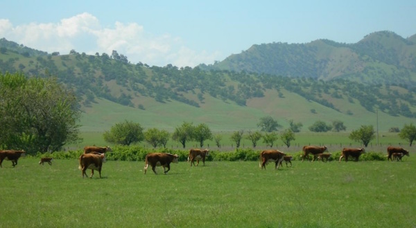
Rangelands are the largest land cover by area in California, covering more than one-half of the state. Though more commonly known for livestock grazing, rangelands provide multiple ecosystem services such as habitats for fish and wildlife and carbon sequestration. Rangelands also provide opportunities for surface and subsurface water collection and storage.
To better understand the potential detrimental effects of climate change and land use change on rangeland ecosystem services, scientists worked with ranchers and land managers to develop six scenarios for the Central Valley and surrounding foothills. The model scenarios were consistent with three Intergovernmental Panel on Climate Change emission scenarios. To date, there are few studies that examine the combined effects of climate and land use change on rangelands.
“Results show the importance of accounting for recharge areas, which provide opportunities for water storage in dry years, in climate-smart land use planning efforts. Given projections for agriculture, more modeling is needed on feedbacks between agricultural expansion on rangelands and water supply," said Lorraine Flint, co-author and research hydrologist with the USGS.
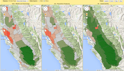 Above: Results of the projections for three scenarios can be compared side by side in the online mapping tool produced by the project. |
Find out moreOnline maps from the research can be accessed at the project's website "Threat Assessments on California Rangelands". These maps are made available for easy access and comparison along with instructions for using them to inform land use decisions. An outreach program for landowners and land managers has been developed by Defenders of Wildlife and the California Rangeland Conservation Coalition to communicate how results can be applied to conservation and land management decisions. All data, publications, and materials resulting from the project are accessible on the project's webpage on the Climate Commons. |
10/2015