Log In or Create Account
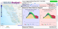
The Watershed Analyst is a rich set of graphing tools paired with the high spatial and temporal resolution Basin Characterization Model climate and hydrology datasets for the watersheds of the San Francisco Bay Area. The graphs display various views of historic patterns compared with modeled future scenarios, including multi-decadal time series, annual seasonal patterns, annual extremes, and water-balance diagrams that together describe the "signature" of water flowing through a watershed. The data can be used to improve understanding of the influence of a warming climate on the timing, amount, and availability of water for biodiversity and habitat conservation planning, and to compare selected GCMs / emission scenarios with one another.
There are also detailed downloadable climate-water summaries for each watershed.
See also this Help Document, QUICK TUTORIAL, and Known Issues.
For the graphs taken from the web page: If you use the graphs or data in your plan or report, please cite the source. Here are suggested citations:
Source of time series graphs: "San Francisco Bay Area Climate-Smart Watershed Analyst - Beta Release". United States Geological Survey. Accessed (date) from the Climate Commons at http://geo.pointblue.org/watershed-analyst/index.php (link is external).
For the downloaded data: Data source: 2014 California Basin Characterization Dataset data extracts by HUC 12 basin. United States Geological Survey. Accessed (date) from the Climate Commons at http://geo.pointblue.org/watershed-analyst/index.php (link is external).