Dataset

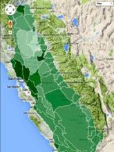
California Rangeland Threats, summary by HUC watershed

Commons Hosting
Climate Commons Hosting Status: 
Not applicable
Other Online Access: 

Also see the online map viewer on the Rangeland threats pages created by this project.

Basic Information

This data collection is the product of the CA LCC-funded project "Climate Change/Land Use Change Scenarios for Habitat Threat Assessments on California Rangelands".

The project aids conservation of California rangelands by identifying future integrated threats of climate change and land use change, and quantifying two main co-benefits of rangeland conservation – water supply and carbon sequestration. Through a multi-stakeholder partnership, the project proponents developed integrated climate change/land use change scenarios for the Central Valley and Chaparral and Oak Woodland eco-regions, and disseminated information about future potential threats to high priority conservation areas within the California Rangeland Conservation Coalition (CRCC) study area, which includes the foothills around the Central Valley and most of the southern Inner Coast Range.

The project team calculated metrics at the landscape and watershed scale for the California Rangeland Conservation Coalition (CRCC) focus area and quantified fragmentation of grazing land; change in bioclimatic distribution of oaks, grassland and shrubland; change in wildlife habitat; change in runoff, recharge and stream discharge; and change in carbon stocks and flux. The project team also developed an on-line tool that includes maps of important areas where changes in water availability and wildlife habitat coincide. Economic analysis of scenarios were applied to quantify costs and benefits to the CRCC landscape. Comparison of analyses across scenarios allows resource managers to identify potential risks and opportunities – both biological and economical – for rangeland across alternative futures.

Format: zipped Shapefiles

Disclaimer: 
Disclaimer: The maps and model results shown are not predictions but should be viewed as multiple scenarios.
Creator: 
USGS Western Geographic Science Center
Contributor: 
USGS California Water Science Center, org: USGS Science and Decisions Center, org: Defenders of Wildlife, org: California LCC
Publisher: 
California Climate Commons
Spatial Resolution: 
HUC 8 watershed
Temporal Coverage: 
2006 to 2050
Date Issued: 
2013
Parameters / Choices
A dataset often contains many geodata layers representing the same kind of measurement, but for different values of some parameters - time periods, models or scenarios, different species, etc. A value must be chosen for each such parameter in order to select a specific layer or raster which associated a single value with each geographic location (cell). The parameters or choices relevant to selecting layers from this dataset are described here.
Climate Models: 
Emission Scenarios: 
File Attachments